
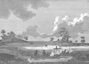
Related Images


Download:
| Tiny | 125x128 | View | Download |
| Small | 251x256 | View | Download |
| Medium | 503x512 | View | Download |
| Original png | 514x523 | View | Download |
| Original as jpg | 514x523 | View | Download |
This image was acquired from
wikimedia. It was marked as Public Domain or CC0 and is free to use. To verify, go to the source and check the information there.
Looking for more info about this image?
Try a Google Reverse Image Search for it.
Try a Google Reverse Image Search for it.
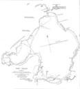
Keywords from Image Description:
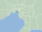
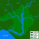
Port Phillip . en January en very basic map of the port phillip plains approximately thousand years ago prior to sea level rise that filled the area of land now known as Port Phillip and the course of the Yarra River as it emptied into Bass Strait More exact details regarding the course of the Yarra River in the port phillip