
Related Images


Download:
| Tiny | 170x128 | View | Download |
| Small | 341x256 | View | Download |
| Medium | 682x512 | View | Download |
| Large | 1365x1024 | View | Download |
| Original | 3648x2736 | View | Download |
This image was acquired from
flickr. It was marked as Public Domain or CC0 and is free to use. To verify, go to the source and check the information there.
Looking for more info about this image?
Try a Google Reverse Image Search for it.
Try a Google Reverse Image Search for it.
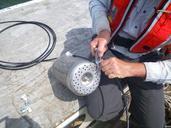
Keywords from Image Description:
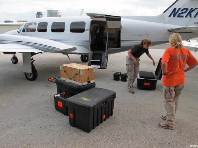
deepwaterhorizon oilspill usgs equipment measurement personnel research outdoor USGS geologists Karen Morgan and Ginger TilingRange load imaging gear for preoil reconnaissance flight. USGS captured more than miles of Florida's coastline from Cedar Key to Flamingo with over aerial photographs. The photographs document conditions