
Related Images


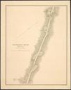
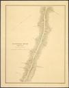
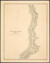
Download:
| Tiny | 245x128 | View | Download |
| Small | 491x256 | View | Download |
| Medium | 983x512 | View | Download |
| Original png | 1274x663 | View | Download |
| Original as jpg | 1274x663 | View | Download |
This image was acquired from
wikimedia. It was marked as Public Domain or CC0 and is free to use. To verify, go to the source and check the information there.
Looking for more info about this image?
Try a Google Reverse Image Search for it.
Try a Google Reverse Image Search for it.
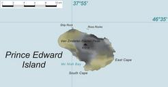
Keywords from Image Description:
PrEdwIsland Map. Karte der PrinzEdwardInsel PrinzEdwardInseln im sdlichen Indischen Ozean Map of Prince Edward Island Prince Edward Islands in the Southern Indian Ocean own based on original from Varp modified by Telim tor PrEdwIsl Map Maps of the Prince Edward Islands