Related Images


Download:
| Tiny | 148x128 | View | Download |
| Small | 297x256 | View | Download |
| Medium | 595x512 | View | Download |
| Large | 1191x1024 | View | Download |
| Original png | 1455x1250 | View | Download |
| Original as jpg | 1455x1250 | View | Download |
This image was acquired from
wikimedia. It was marked as Public Domain or CC0 and is free to use. To verify, go to the source and check the information there.
Looking for more info about this image?
Try a Google Reverse Image Search for it.
Try a Google Reverse Image Search for it.
Keywords from Image Description:
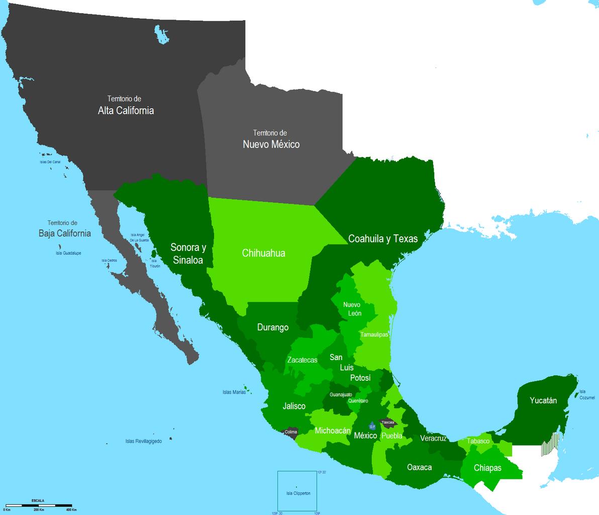
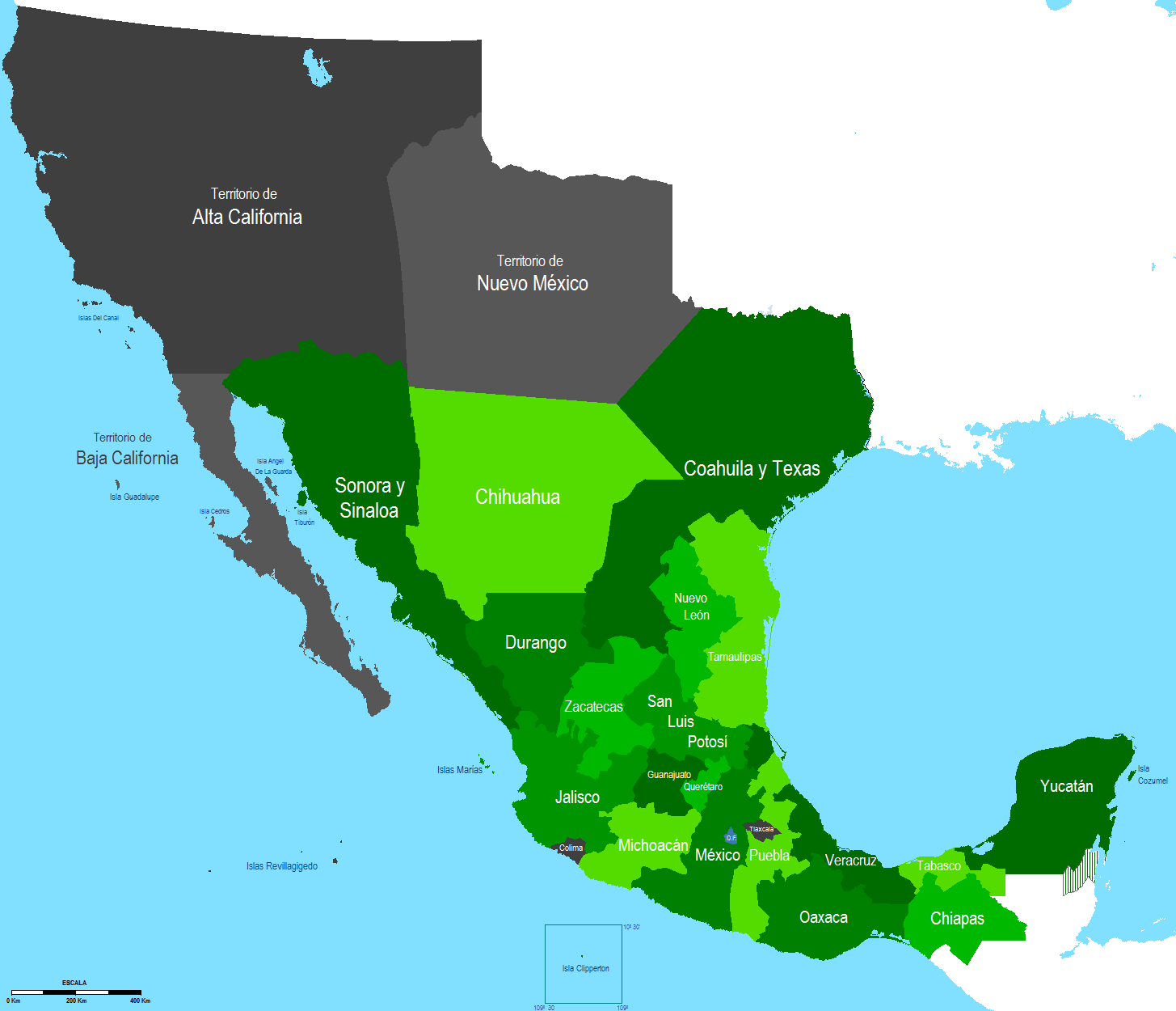
Primera Republica Federal . Political divisions of Mexico location map scheme svg en First Federal Republic es Mapa de Mexico en durante la Primera Republica Federal own Hpav File Mexico equirectangular projection Territorial evolution of Mexico Mexico in the s