
Related Images


Download:
| Tiny | 239x128 | View | Download |
| Original png | 463x247 | View | Download |
| Original as jpg | 463x247 | View | Download |
This image was acquired from
wikimedia and wikimedia. It was marked as Public Domain or CC0 and is free to use. To verify, go to the source and check the information there.
Looking for more info about this image?
Try a Google Reverse Image Search for it.
Try a Google Reverse Image Search for it.
Keywords from Image Description:
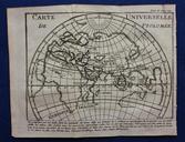
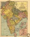
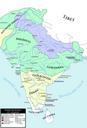
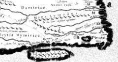
Ptolomy map. Ancient Map of India detail from the Roman en Peutinger Table Produced around AD this is the most detailed map we have of India after Ptolemy's Geographica until the Middle Ages This detail shows only about of the total Peutinger Table Italy makes up about yet is supposed to show most of Central and all of South Asia