
Related Images


Download:
| Tiny | 169x128 | View | Download |
| Small | 339x256 | View | Download |
| Medium | 679x512 | View | Download |
| Large | 1359x1024 | View | Download |
| Original | 3616x2724 | View | Download |
This image was acquired from
wikimedia. It was marked as Public Domain or CC0 and is free to use. To verify, go to the source and check the information there.
Looking for more info about this image?
Try a Google Reverse Image Search for it.
Try a Google Reverse Image Search for it.
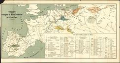
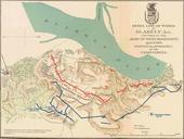
Keywords from Image Description:
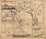
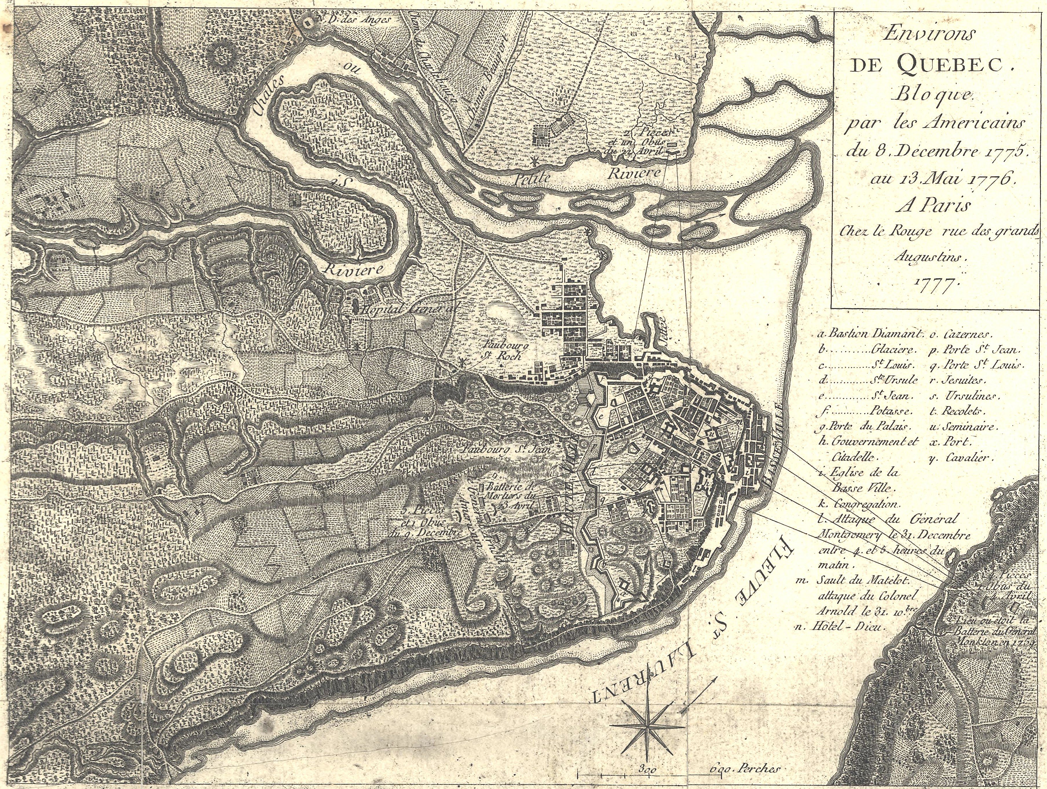
QuebecFrenchMap. Artwork en This is French map showing the Battle and Siege of Quebec December to May It has had its border cropped and had slight contrast and brightness adjustments made The caption reads Environs de Quebec Bloque par les Americains du December au Mai Translated Quebec area besieged by the Americans December