Related Images
Download:
| Tiny | 139x128 | View | Download |
| Small | 279x256 | View | Download |
| Medium | 559x512 | View | Download |
| Large | 1118x1024 | View | Download |
| Original svg | 1719x1574 | View | Download |
| Original as jpg | 1719x1574 | View | Download |
This image was acquired from
wikimedia. It was marked as Public Domain or CC0 and is free to use. To verify, go to the source and check the information there.
Looking for more info about this image?
Try a Google Reverse Image Search for it.
Try a Google Reverse Image Search for it.
Keywords from Image Description:
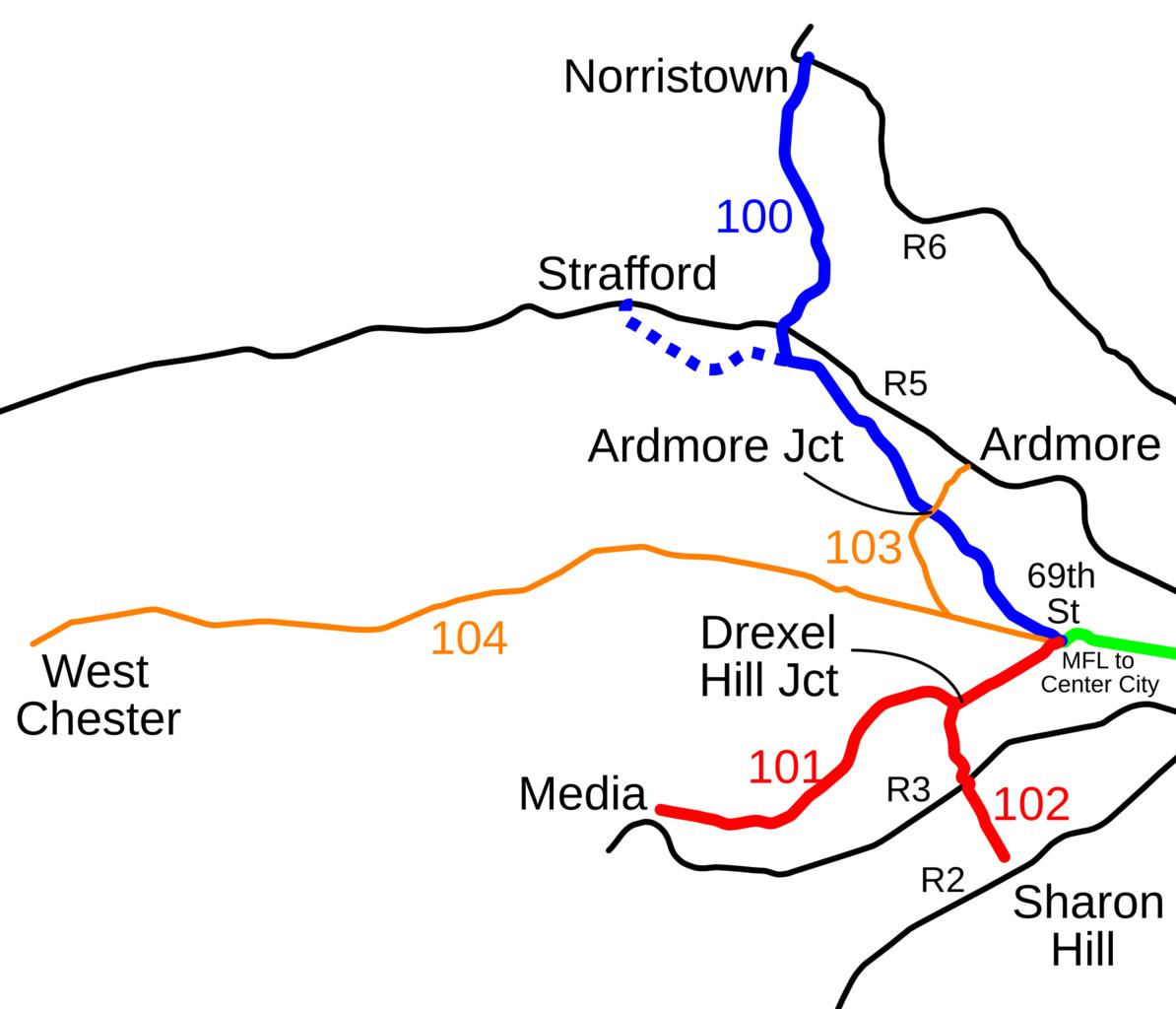
Red Arrow map.svg Map of the former Red Arrow trolley lines some of which are now run by SEPTA Blue is the Norristown High Speed Line red and is the Media and Sharon Hill lines and orange and is former trolley lines now bus Regional Rail is in black own User SPUI spuimap Public transport maps of Philadelphia Rail transport