
Related Images


Download:
| Tiny | 126x128 | View | Download |
| Small | 252x256 | View | Download |
| Medium | 504x512 | View | Download |
| Large | 1009x1024 | View | Download |
| Original | 3055x3099 | View | Download |
This image was acquired from
wikimedia. It was marked as Public Domain or CC0 and is free to use. To verify, go to the source and check the information there.
Looking for more info about this image?
Try a Google Reverse Image Search for it.
Try a Google Reverse Image Search for it.
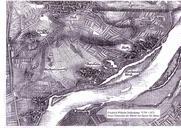
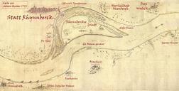
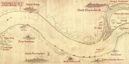
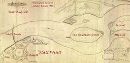
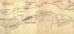
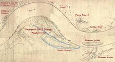
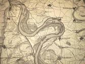
Keywords from Image Description:
Rheinkarte. en Historic map of different riverbeds of Rhine and Neckar from the th century until de Historische Landkarte alter Flusslufe von Rhein und Neckar vom Jahrhundert bis von Speyer und Heidelberg bis Worms Originaltitel Charte des alten Flulaufes im OberRheinThal Legende auch ganz unten auf der Karte die Farbabstufungen