Related Images


Download:
| Tiny | 160x128 | View | Download |
| Small | 321x256 | View | Download |
| Medium | 643x512 | View | Download |
| Large | 1287x1024 | View | Download |
| Original | 1840x1463 | View | Download |
This image was acquired from
wikimedia and flickr. It was marked as Public Domain or CC0 and is free to use. To verify, go to the source and check the information there.
Looking for more info about this image?
Try a Google Reverse Image Search for it.
Try a Google Reverse Image Search for it.
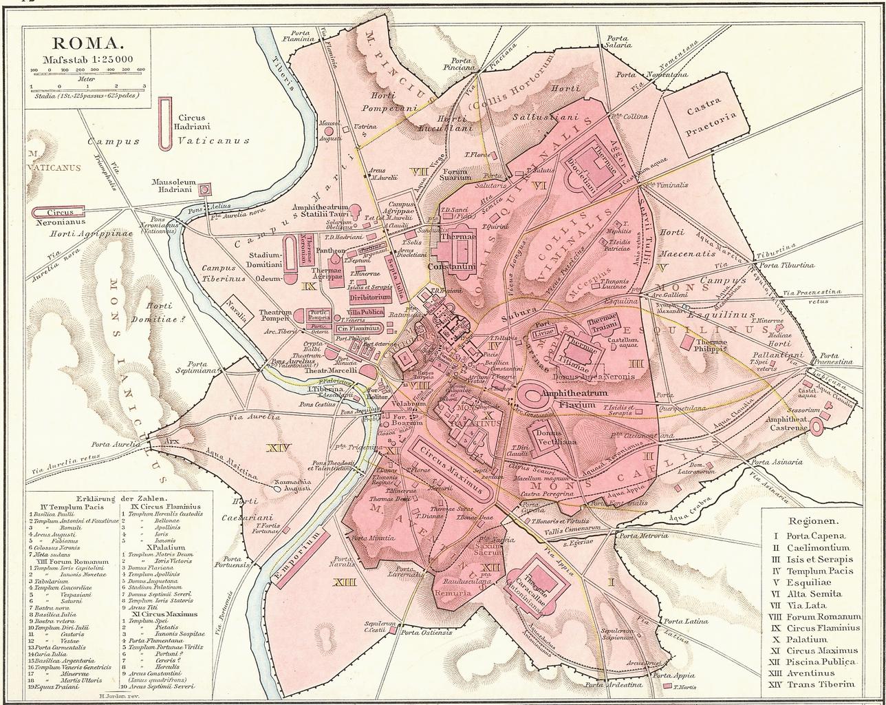
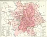
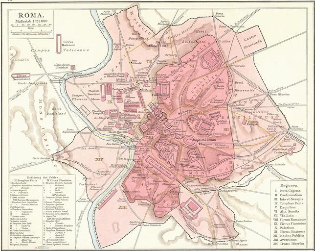
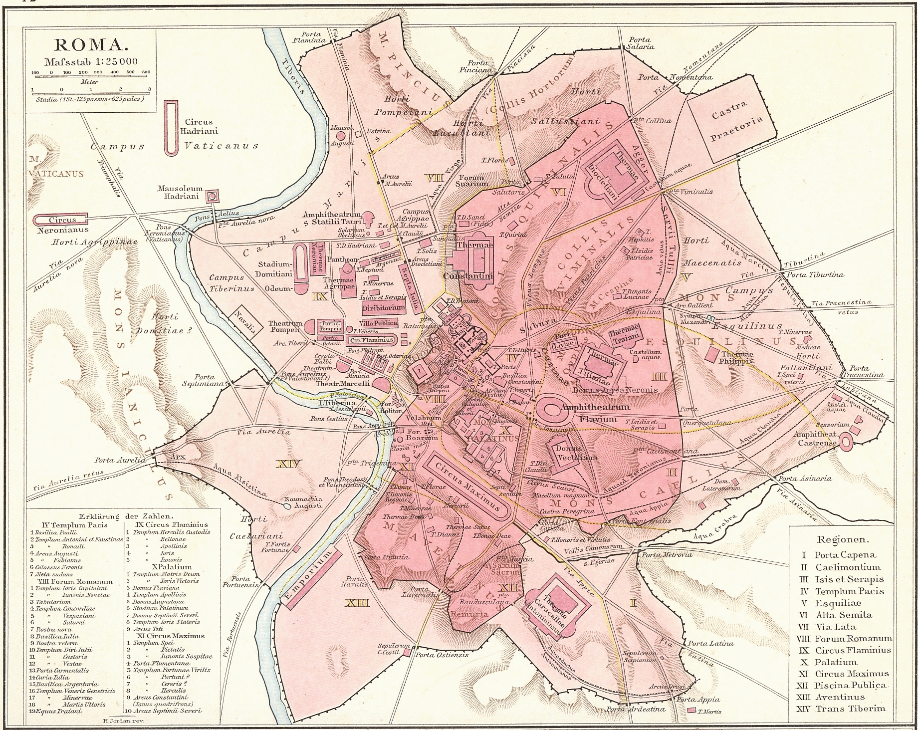
Keywords from Image Description:
drawing map sketch tangle cartoon illustration G. Droysens Allgemeiner Historischer Handatlas G. Droysens Allgemeiner Historischer Handatlas Roma Plan. Plan Roms im Altertum Map of Rome during Antiquity Droysens Allgemeiner Historischer Handatlas Author Jordan PDold file Roma Plan bw file Map of ancient Rome svg On July th