Related Images


Download:
| Tiny | 177x128 | View | Download |
| Small | 355x256 | View | Download |
| Medium | 710x512 | View | Download |
| Large | 1421x1024 | View | Download |
| Original | 8397x6048 | View | Download |
This image was acquired from
wikimedia. It was marked as Public Domain or CC0 and is free to use. To verify, go to the source and check the information there.
Looking for more info about this image?
Try a Google Reverse Image Search for it.
Try a Google Reverse Image Search for it.
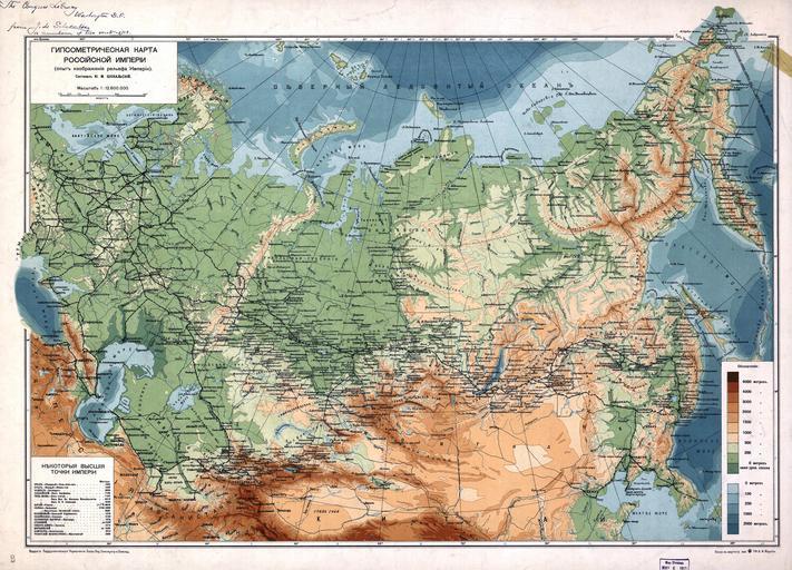
Keywords from Image Description:
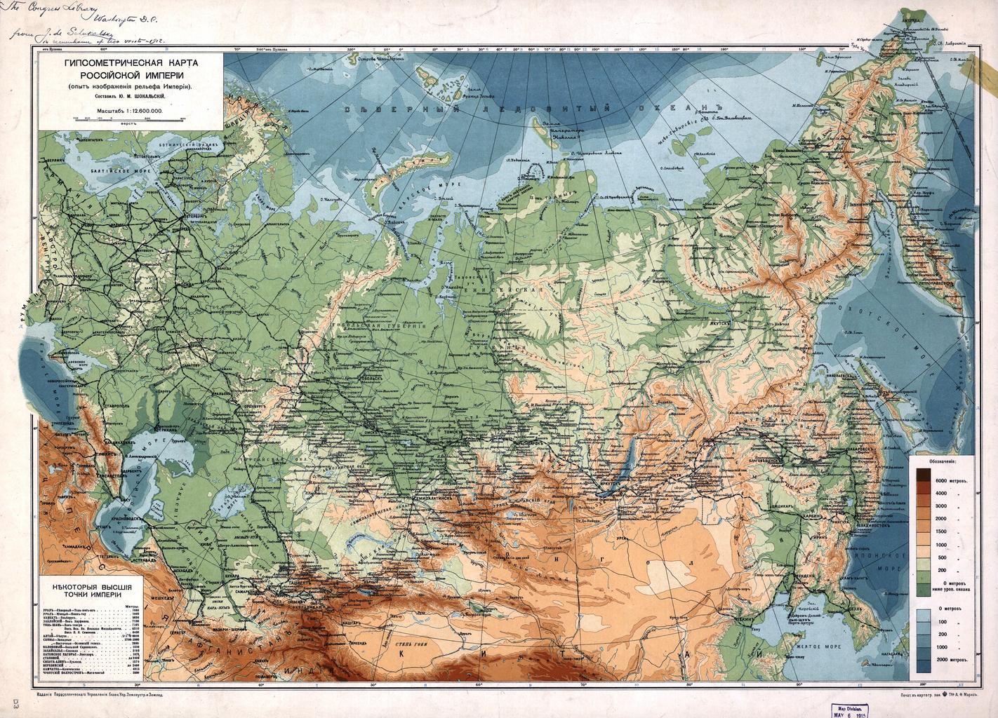
Russian Empire Map. Gipsomietriieskaja karta Rossjskoj Impieri opyt izobraienja riel'iefa Impieri sostavil JU okal'skj NOTES Relief and depths shown by gradient tints Also shows railroads In Russian Pulkovo St Petersburg meridian Includes table of extreme high elevations LC copy torn at edge taped inscribed in ink by the author