
Related Images


Download:
| Tiny | 85x128 | View | Download |
| Small | 170x256 | View | Download |
| Medium | 341x512 | View | Download |
| Large | 682x1024 | View | Download |
| Original png | 2806x4209 | View | Download |
| Original as jpg | 2806x4209 | View | Download |
This image was acquired from
wikimedia. It was marked as Public Domain or CC0 and is free to use. To verify, go to the source and check the information there.
Looking for more info about this image?
Try a Google Reverse Image Search for it.
Try a Google Reverse Image Search for it.
Keywords from Image Description:
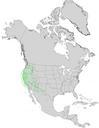
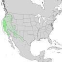
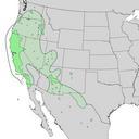
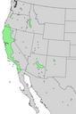
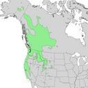
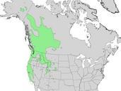
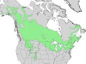
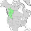
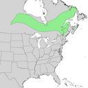
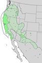
Salix lasiolepis range map . en Natural distribution map for Salix lasiolepis arroyo willow The more specific bright green ranges are from Little and the more general lighter graygreen regions north of Mexico only are from Argus cr usgs gov USGS Geosciences and Environmental Change Science Center Digital Representations of Tree