
Related Images


Download:
| Tiny | 127x128 | View | Download |
| Small | 255x256 | View | Download |
| Medium | 511x512 | View | Download |
| Large | 1022x1024 | View | Download |
| Original png | 1781x1783 | View | Download |
| Original as jpg | 1781x1783 | View | Download |
This image was acquired from
wikimedia. It was marked as Public Domain or CC0 and is free to use. To verify, go to the source and check the information there.
Looking for more info about this image?
Try a Google Reverse Image Search for it.
Try a Google Reverse Image Search for it.
Keywords from Image Description:
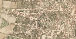
Saska Kpa. pl Mapa Saskiej Kpy Warszawie Mapa topograficzna Wojskowego Instytutu Geograficznego ark Pas Sup WarszawaMokotw naniesionym przebiegiem wspczesnych waniejszych ulic oraz granicami osiedli uchwalonymi przez Rad Dzielnicy Praga Poudnie granicami obszarw wg Miejskiego Systemu Informacji Wojskowy Instytut Geograficzny own