
Related Images


Download:
| Tiny | 72x128 | View | Download |
| Small | 144x256 | View | Download |
| Medium | 289x512 | View | Download |
| Large | 578x1024 | View | Download |
| Original | 5834x10327 | View | Download |
This image was acquired from
wikimedia. It was marked as Public Domain or CC0 and is free to use. To verify, go to the source and check the information there.
Looking for more info about this image?
Try a Google Reverse Image Search for it.
Try a Google Reverse Image Search for it.
Keywords from Image Description:
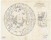
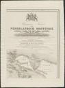
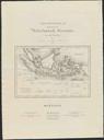
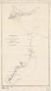
Schetskaart van het terrein doorloopen gedurende de militaire excursie naat het Tobameer in de maanden Febr.i tot en met Juni UvABC OTM HBKZL . Schetskaart van het terrein doorloopen gedurende de militaire excursie naat het Tobameer in de maanden Febr tot en met Juni Scale Lithogr cm Institution Special Collections of the