
Related Images


Download:
| Tiny | 158x128 | View | Download |
| Small | 317x256 | View | Download |
| Medium | 635x512 | View | Download |
| Large | 1271x1024 | View | Download |
| Original | 5199x4188 | View | Download |
This image was acquired from
wikimedia. It was marked as Public Domain or CC0 and is free to use. To verify, go to the source and check the information there.
Looking for more info about this image?
Try a Google Reverse Image Search for it.
Try a Google Reverse Image Search for it.
Keywords from Image Description:
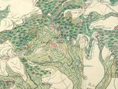
Schlauroth Karte von . Beschreibung Grund Riss oder planimetrischer Entwurff des bey Grlitz in der Oberlausitz am Fusse des Berges die LandesCrone genannt gelegenen Dorffes Schlauroth wie es sich nach seinen ckern Wiesen Gehoelzen Teichen Wegen Stegen und Grenzen befunde Oberlausitzische Bibliothek der Wissenschaften Inv Nr OLB VII