
Related Images


Download:
| Tiny | 192x128 | View | Download |
| Small | 385x256 | View | Download |
| Medium | 770x512 | View | Download |
| Original | 960x638 | View | Download |
This image was acquired from
wikimedia. It was marked as Public Domain or CC0 and is free to use. To verify, go to the source and check the information there.
Looking for more info about this image?
Try a Google Reverse Image Search for it.
Try a Google Reverse Image Search for it.
Keywords from Image Description:
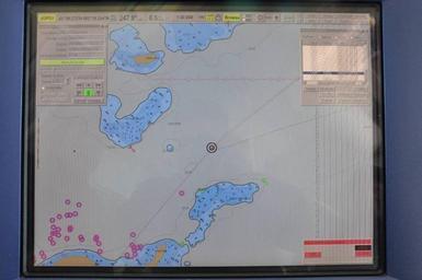
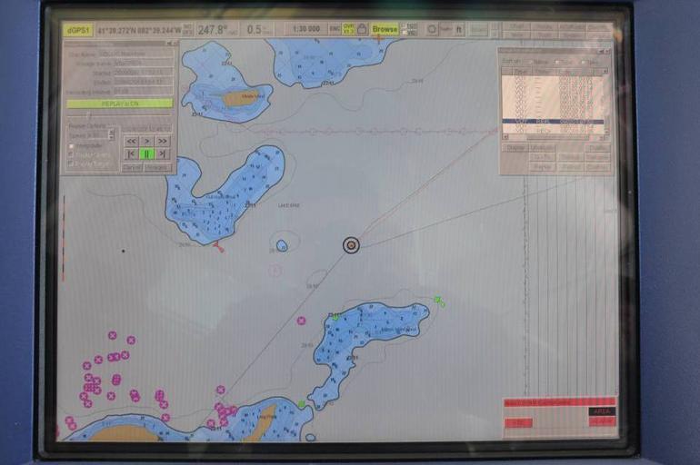
Screengrab from USCGC Mackinaw's electronic chart Saturday Feb DVIDS. en In this screengrab from Coast Guard Cutter Mackinaw's electronic chart the black circles represent the Mackinaw's position This point miles northeast of Locust Point was the closest the Mackinaw got to the scene The red line represents Mackinaw's intended trackline