Related Images


Download:
| Tiny | 322x128 | View | Download |
| Small | 645x256 | View | Download |
| Medium | 1290x512 | View | Download |
| Original png | 1600x635 | View | Download |
| Original as jpg | 1600x635 | View | Download |
This image was acquired from
wikimedia. It was marked as Public Domain or CC0 and is free to use. To verify, go to the source and check the information there.
Looking for more info about this image?
Try a Google Reverse Image Search for it.
Try a Google Reverse Image Search for it.
Keywords from Image Description:
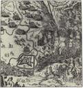
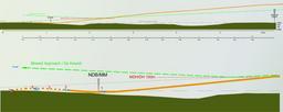
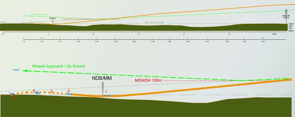
Smolensk NordAPP. en Final approach for Smolensk Nord Airbase RWY First broken branches near NDB marker Left wing collision with birch tree Broken wingtip Uncontrolled flight with roll Terain impact gray line correct final approach orange line actual flight path by the Final report red line decision height descent height ft