
Related Images


Download:
| Tiny | 128x128 | View | Download |
| Small | 256x256 | View | Download |
| Medium | 512x512 | View | Download |
| Original png | 1024x1024 | View | Download |
| Original as jpg | 1024x1024 | View | Download |
This image was acquired from
wikimedia. It was marked as Public Domain or CC0 and is free to use. To verify, go to the source and check the information there.
Looking for more info about this image?
Try a Google Reverse Image Search for it.
Try a Google Reverse Image Search for it.
Keywords from Image Description:
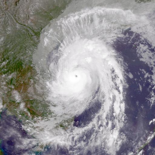
SonTinh Oct Z. en The MTSAT satellite on October captured this infrared satellite image of Typhoon SonTinh at peak intensity off the southern coast of Hainan island on October with an kilometer wide eye nrlmry navy mil html NOAA NRL Monterey Marine Meteorology Division Typhoon SonTinh PDUSGov