Related Images


Download:
| Tiny | 164x128 | View | Download |
| Small | 329x256 | View | Download |
| Medium | 659x512 | View | Download |
| Large | 1318x1024 | View | Download |
| Original | 5710x4436 | View | Download |
This image was acquired from
wikimedia. It was marked as Public Domain or CC0 and is free to use. To verify, go to the source and check the information there.
Looking for more info about this image?
Try a Google Reverse Image Search for it.
Try a Google Reverse Image Search for it.
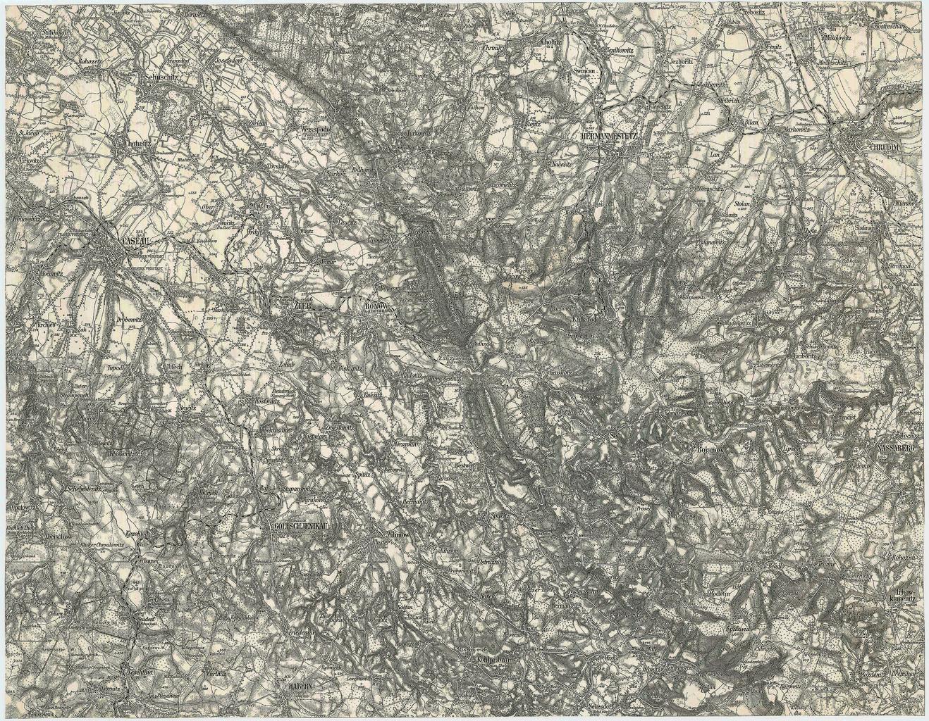
Keywords from Image Description:
Spezialkarte Caslau und Chrudim auf dpi farbig. historische Landkarte Spezialkarte franziscojosephinische Landesaufnahme der sterreichischungarischen Monarchie Blatt Caslau Zone Kol XIII im blichen Blattschnitt mit dem Tal der Doubrawa Chrudim Habern Nassaberg Goltsch Jenikau Zleb Hermanmestez Ronow militrgeographisches Institut