
Related Images


Download:
| Tiny | 153x128 | View | Download |
| Small | 307x256 | View | Download |
| Medium | 614x512 | View | Download |
| Large | 1229x1024 | View | Download |
| Original | 3580x2982 | View | Download |
This image was acquired from
wikimedia. It was marked as Public Domain or CC0 and is free to use. To verify, go to the source and check the information there.
Looking for more info about this image?
Try a Google Reverse Image Search for it.
Try a Google Reverse Image Search for it.
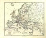
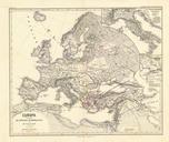
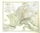
Keywords from Image Description:
SprunerMenke Handatlas Karte . Kaiserthum Frankreich in seiner weitesten Ausdehnung unter Napoleon Karl Spruner von Merz Heinrich Theodor Menke HandAtlas fr die Geschichte des Mittelalters und der neueren Zeit Auflage Gotha Justus Perthes Creator Heinrich Theodor Menke Creator Karl Spruner von Merz de pl urn urn nbn de gbv ppn