
Related Images


Download:
| Tiny | 93x128 | View | Download |
| Small | 187x256 | View | Download |
| Medium | 374x512 | View | Download |
| Large | 748x1024 | View | Download |
| Original | 1275x1744 | View | Download |
This image was acquired from
wikimedia. It was marked as Public Domain or CC0 and is free to use. To verify, go to the source and check the information there.
Looking for more info about this image?
Try a Google Reverse Image Search for it.
Try a Google Reverse Image Search for it.
Keywords from Image Description:
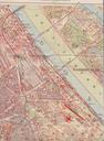
Stadtplan Praterstern . en Part of city map of the nd district of Vienna showing the Praterstern traffic junction Reichsbrcke bridge over the Danube river and adjacent parts of Prater amusement park de Ausschnitt aus einem Stadtplan des Wiener Gemeindebezirks mit dem Praterstern der Reichsbrcke ber die Donau und angrenzenden Teilen