
Related Images


Download:
| Tiny | 79x128 | View | Download |
| Small | 158x256 | View | Download |
| Medium | 316x512 | View | Download |
| Large | 632x1024 | View | Download |
| Original png | 680x1101 | View | Download |
| Original as jpg | 680x1101 | View | Download |
This image was acquired from
wikimedia. It was marked as Public Domain or CC0 and is free to use. To verify, go to the source and check the information there.
Looking for more info about this image?
Try a Google Reverse Image Search for it.
Try a Google Reverse Image Search for it.
Keywords from Image Description:
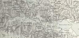
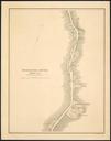
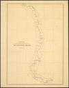
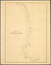
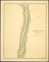
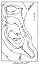
Stahlin map of Varybopi. en Map from Das hellenische Thessalien by Friedrich Sthlin showing rough sketch of the archaeological site at Varybopi modern Makrakomi in southern Thessaly Friedrich Sthlin Das hellenische Thessalien Stuttgart Friedrich Sthlin PDold Maps of archeological sites of ancient Greece Maps in German