
Related Images


This image was acquired from
wikimedia. It was marked as Public Domain or CC0 and is free to use. To verify, go to the source and check the information there.
Looking for more info about this image?
Try a Google Reverse Image Search for it.
Try a Google Reverse Image Search for it.
Keywords from Image Description:
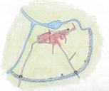
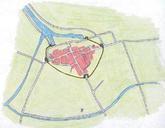
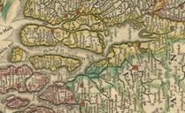
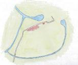
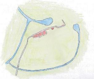
Steenbergen vroegst. en drawing made part of series of five drawings on the urban development of Steenbergen of which will upload The drawing is based on vastly more detailed blackandwhite maps found in the book 'Steenbergen in de Middeleeuwen' by Delahaye et al own Westbrabander Maps of Steenbergen