
Related Images

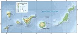
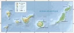

Download:
| Tiny | 175x128 | View | Download |
| Small | 350x256 | View | Download |
| Medium | 700x512 | View | Download |
| Large | 1401x1024 | View | Download |
| Original svg | 2237x1635 | View | Download |
| Original as jpg | 2237x1635 | View | Download |
This image was acquired from
wikimedia. It was marked as Public Domain or CC0 and is free to use. To verify, go to the source and check the information there.
Looking for more info about this image?
Try a Google Reverse Image Search for it.
Try a Google Reverse Image Search for it.
Keywords from Image Description:
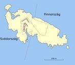
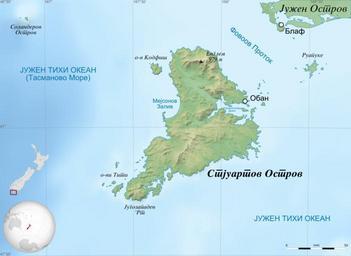
Stewart Island mapmk.svg New Zealand Geodetic Datum GRS ' Stewart Island Rakiura New Zealand in Macedonian Altitude levels etc same for bathymetry Projection New Zealand Geodetic Datum GRS datum Standard meridian ' True scale parallel Geographic limits of the map