
Related Images


Download:
| Tiny | 138x128 | View | Download |
| Small | 277x256 | View | Download |
| Medium | 555x512 | View | Download |
| Large | 1111x1024 | View | Download |
| Original | 18969x17474 | View | Download |
This image was acquired from
wikimedia. It was marked as Public Domain or CC0 and is free to use. To verify, go to the source and check the information there.
Looking for more info about this image?
Try a Google Reverse Image Search for it.
Try a Google Reverse Image Search for it.
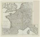
Keywords from Image Description:
Tableau gnral et itinraire de l'Empire franais btvbr. Divisions politiques et administratives Forts France Angleterre Sud Rhin Confdration du Ouest Italie Nord Espagne Nord chelle environ Size cm Institution Bibliothque nationale de France dpartement Cartes et plans object history exhibition history credit line accession