
Related Images


Download:
| Tiny | 115x128 | View | Download |
| Small | 231x256 | View | Download |
| Medium | 463x512 | View | Download |
| Large | 926x1024 | View | Download |
| Original | 6174x6826 | View | Download |
This image was acquired from
wikimedia. It was marked as Public Domain or CC0 and is free to use. To verify, go to the source and check the information there.
Looking for more info about this image?
Try a Google Reverse Image Search for it.
Try a Google Reverse Image Search for it.
Keywords from Image Description:
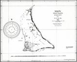
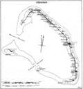
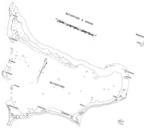
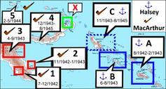
Tarawa Map. Government map some maps in the series include the following Compiled by Lands and Surveys Betio Tarawa this map Lands Surveys Betio February Original obtained either directly from GEIDA or from Government source USACOE as blueline printing sometime in the believe these maps were produced for government use by the Gilbert