
Related Images


Download:
| Tiny | 175x128 | View | Download |
| Small | 351x256 | View | Download |
| Medium | 703x512 | View | Download |
| Original | 1240x902 | View | Download |
This image was acquired from
wikimedia. It was marked as Public Domain or CC0 and is free to use. To verify, go to the source and check the information there.
Looking for more info about this image?
Try a Google Reverse Image Search for it.
Try a Google Reverse Image Search for it.
Keywords from Image Description:
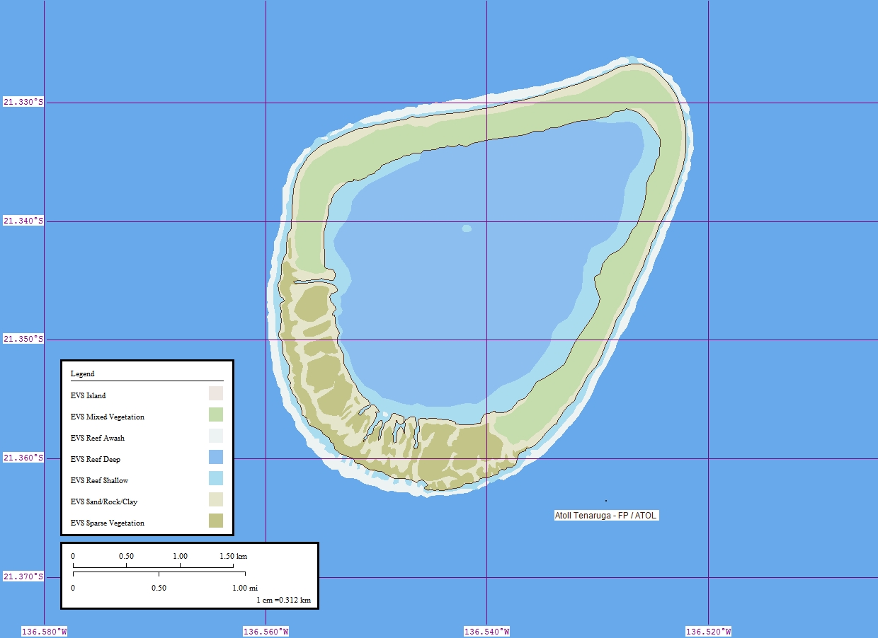
Tenarunga Map. EVS precision islands map of Tenarunga Atoll Tuamotu Archipelago French Polynesia own using Landsat Global Mapper and Marplot Peter Minton California evsrequest gmail Peter Minton Original upload log All user names refer to en Pjminton KB no Created by Peter Minton evsrequest gmail using Landsat Global Mapper