
Related Images


Download:
| Tiny | 110x128 | View | Download |
| Small | 221x256 | View | Download |
| Medium | 442x512 | View | Download |
| Large | 884x1024 | View | Download |
| Original | 1102x1276 | View | Download |
This image was acquired from
wikimedia. It was marked as Public Domain or CC0 and is free to use. To verify, go to the source and check the information there.
Looking for more info about this image?
Try a Google Reverse Image Search for it.
Try a Google Reverse Image Search for it.
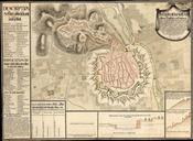
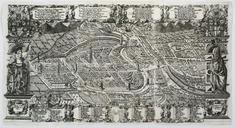
Keywords from Image Description:
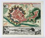
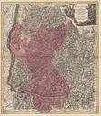
The Breisgau circa . en After and the loss of Alsace to France the Breisgau was the westernmost and largest territory of Further Austria Vorlande Map of the Breisgau published by Matthus Seutter bergbook cgi search Germany paint Matthus Seutter circa PDold Uploaded with Breisgau Further Austria Old maps of the Holy Roman Empire