
Related Images

Download:
| Tiny | 74x128 | View | Download |
| Small | 149x256 | View | Download |
| Medium | 299x512 | View | Download |
| Large | 599x1024 | View | Download |
| Original | 1211x2069 | View | Download |
This image was acquired from
wikimedia. It was marked as Public Domain or CC0 and is free to use. To verify, go to the source and check the information there.
Looking for more info about this image?
Try a Google Reverse Image Search for it.
Try a Google Reverse Image Search for it.
Keywords from Image Description:
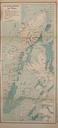
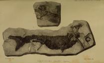
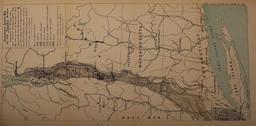
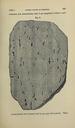
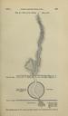
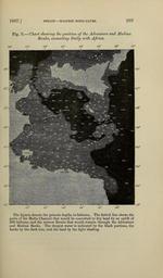
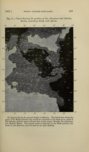
The Quarterly journal of the Geological Society of London . SPEATT MALTESE BONECAVES Fig Chart shoiving the position of the Adventure and Medina BanJcs connecting Sicily with Africa The figures denote the present depths in fathoms The dotted line shows the parts of the Malta Channel that would be converted to dry land by