
Related Images

Download:
| Tiny | 76x128 | View | Download |
| Small | 152x256 | View | Download |
| Medium | 304x512 | View | Download |
| Large | 609x1024 | View | Download |
| Original | 1226x2061 | View | Download |
This image was acquired from
wikimedia. It was marked as Public Domain or CC0 and is free to use. To verify, go to the source and check the information there.
Looking for more info about this image?
Try a Google Reverse Image Search for it.
Try a Google Reverse Image Search for it.
Keywords from Image Description:
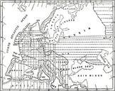
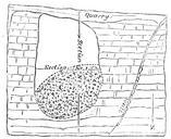
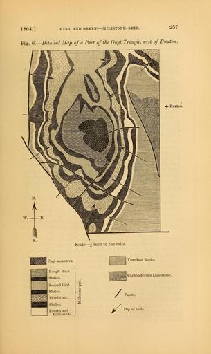
The Quarterly journal of the Geological Society of London . HULL AND GREEN MILLSTONE GEIT Fig Detailed Map of Part of the Ooyt Trough ivest of Buxton Buxton Scale inch to the mile Coalmeasures Rough Rock Shales Second Grit Shales Third Grit Shales Fourth and Fifth Grits Yoredale Rocks iii Carboniferous Limestone