
Related Images


This image was acquired from
wikimedia. It was marked as Public Domain or CC0 and is free to use. To verify, go to the source and check the information there.
Looking for more info about this image?
Try a Google Reverse Image Search for it.
Try a Google Reverse Image Search for it.
Keywords from Image Description:
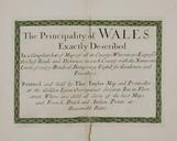
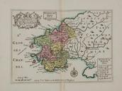
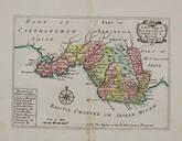
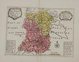
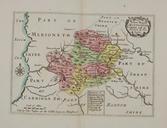
Thomas Taylor Montgomeryshire. Twelve maps of the counties of Wales excluding Monmouthshire on ten plates naming larger settlements and estates and showing roads hundreds rivers and uplands latter pictorially mm Institution National Library of Wales credit line Scale ca inches miles LangSwitch Llyfrgell Genedlaethol Cymru