Related Images

This image was acquired from
wikimedia. It was marked as Public Domain or CC0 and is free to use. To verify, go to the source and check the information there.
Looking for more info about this image?
Try a Google Reverse Image Search for it.
Try a Google Reverse Image Search for it.
Keywords from Image Description:
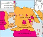
TransSaharan routes early.svg en Trade routes of the Western Sahara Goldfields are indicated by light brown shading Map Map data from naturalearthdata data Projection Equirectangular Lat plate carre Map limits Software Grass GIS Inkscape Scaled in Inkscape to give pixels per degree Routes The routes shown are based those