Related Images


Download:
| Tiny | 83x128 | View | Download |
| Small | 166x256 | View | Download |
| Medium | 332x512 | View | Download |
| Large | 664x1024 | View | Download |
| Original png | 1126x1736 | View | Download |
| Original as jpg | 1126x1736 | View | Download |
This image was acquired from
wikimedia. It was marked as Public Domain or CC0 and is free to use. To verify, go to the source and check the information there.
Looking for more info about this image?
Try a Google Reverse Image Search for it.
Try a Google Reverse Image Search for it.
Keywords from Image Description:
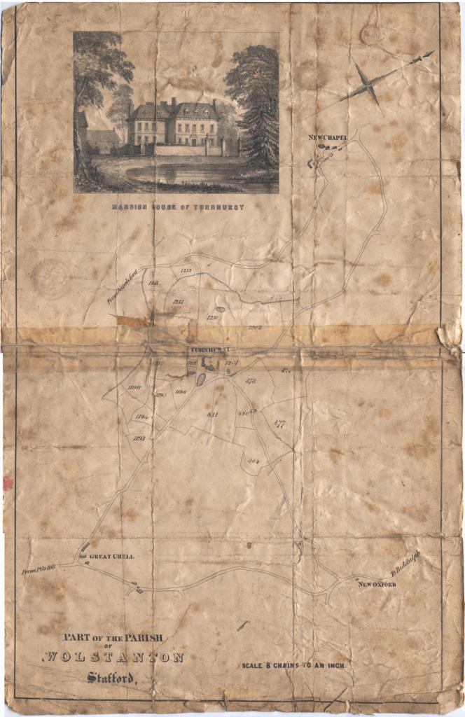
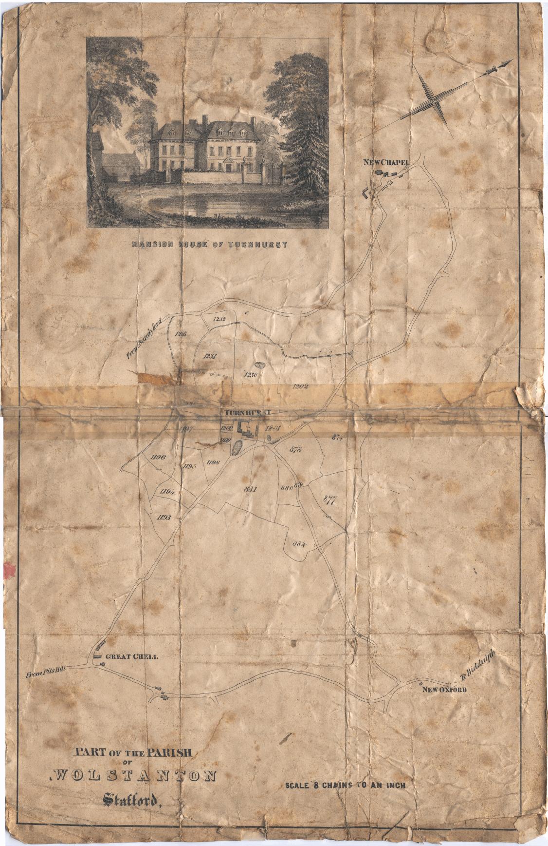
Turnhurst Estate Map c. Map showing part of the parish of Wolstanton Staffordshire England centred on Turnhurst Hall Scanned from the original document Created prior to th July The original document carries post mark with this date Not known The original document was left in the family of Edward Cole who lived at Turnhurst until