
Related Images


This image was acquired from
wikimedia. It was marked as Public Domain or CC0 and is free to use. To verify, go to the source and check the information there.
Looking for more info about this image?
Try a Google Reverse Image Search for it.
Try a Google Reverse Image Search for it.
Keywords from Image Description:
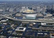
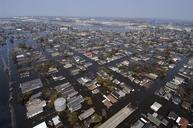
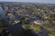
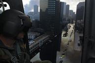
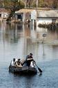
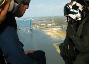
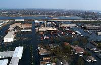
UpperthFloodingNavyAirView. An aerial view of the flooded areas of New Orleans caused by Hurricane Katrina View shows Upper th Ward with the Industrial Canal in distance Claiborne Avenue Bridge at right Navy photo by Chief Petty Officer Johnny Bivera via pentagon gov pentagon gov html Not dated Probably early September Navy photo