
Related Images


Download:
| Tiny | 194x128 | View | Download |
| Small | 388x256 | View | Download |
| Medium | 777x512 | View | Download |
| Large | 1554x1024 | View | Download |
| Original | 3199x2107 | View | Download |
This image was acquired from
wikimedia. It was marked as Public Domain or CC0 and is free to use. To verify, go to the source and check the information there.
Looking for more info about this image?
Try a Google Reverse Image Search for it.
Try a Google Reverse Image Search for it.
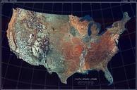
Keywords from Image Description:
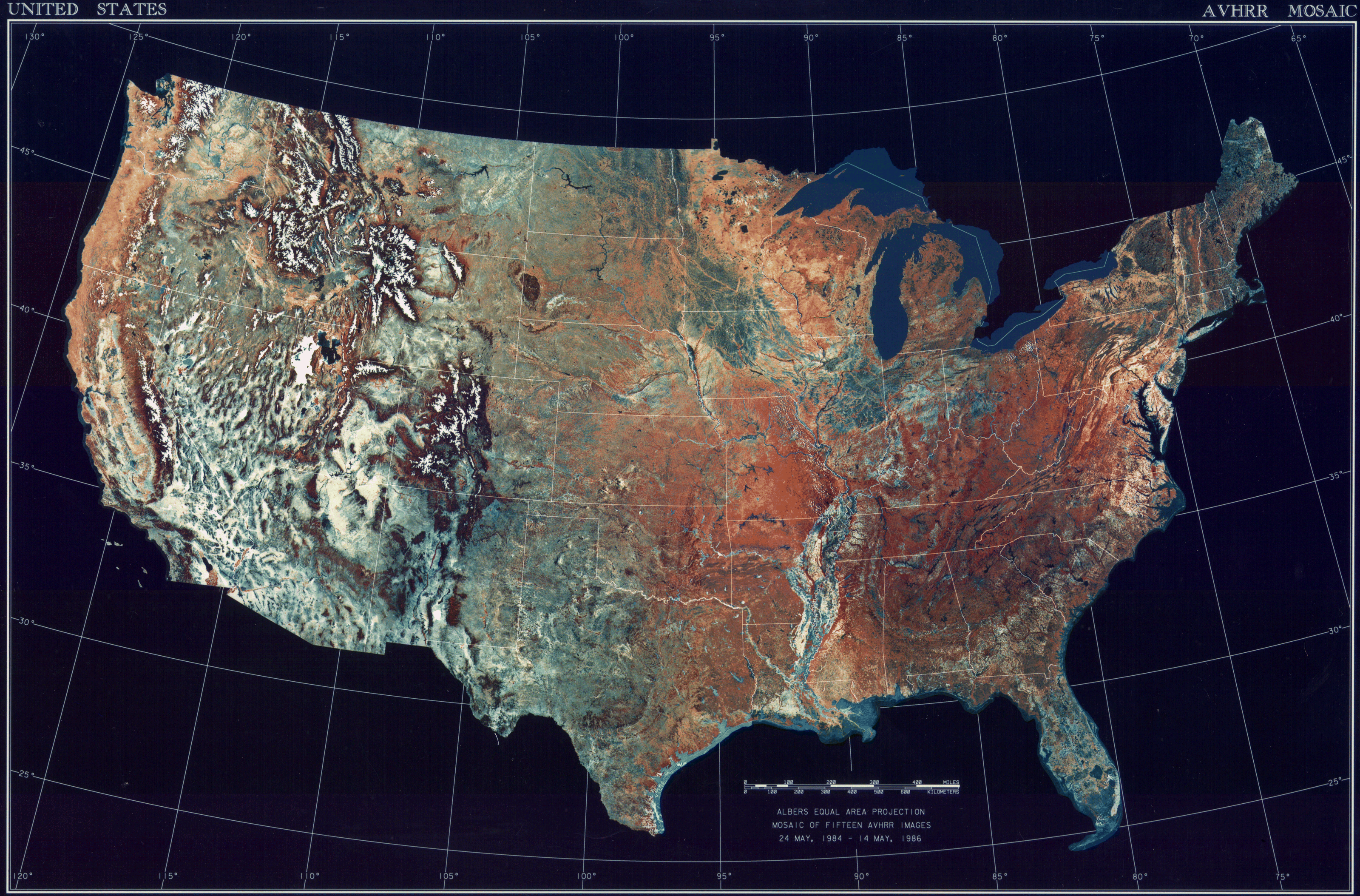
USATopographicalMap. Satellitenbild der Zentralstaaten der Vereinigten Staaten AVHRR satellite image with topography of the contiguous states of the United States Mapa de los estados continentales contiguos de los Estados Unidos ncdc noaa gov National Climactic Data Center Satellite and Information Service Dept of Commerce