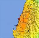
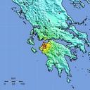
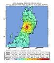
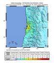
Related Images


Download:
| Tiny | 124x128 | View | Download |
| Small | 249x256 | View | Download |
| Medium | 499x512 | View | Download |
| Original png | 524x537 | View | Download |
| Original as jpg | 524x537 | View | Download |
This image was acquired from
wikimedia. It was marked as Public Domain or CC0 and is free to use. To verify, go to the source and check the information there.
Looking for more info about this image?
Try a Google Reverse Image Search for it.
Try a Google Reverse Image Search for it.
Keywords from Image Description:
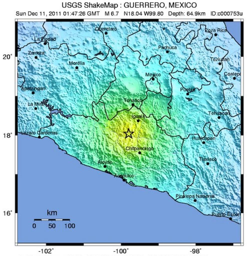
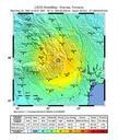
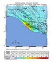
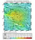
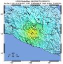
USGS Guerrero shakemap. en map depicting the intensity of the earthquake that occurred in Guerrero Mexico on December usgs gov United States Geological Survey USGS PDUSGov Uncategorized April