
Related Images


Download:
| Tiny | 153x128 | View | Download |
| Small | 307x256 | View | Download |
| Medium | 614x512 | View | Download |
| Original | 750x625 | View | Download |
This image was acquired from
wikimedia. It was marked as Public Domain or CC0 and is free to use. To verify, go to the source and check the information there.
Looking for more info about this image?
Try a Google Reverse Image Search for it.
Try a Google Reverse Image Search for it.
Keywords from Image Description:
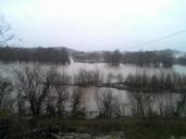
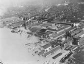
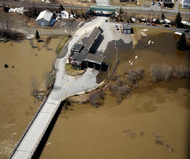
Van Buren Maine aerial during flood. Aerial photograph of the US Border Inspection Station at Van Buren Maine taken by the US Government during the flood of May br Other information Photo was part of GSA presentation to the Transportation Border Working Group in April thetbwg org ppt May General Services Administration ImageNoteControl