Related Images


Download:
| Tiny | 165x128 | View | Download |
| Small | 331x256 | View | Download |
| Medium | 663x512 | View | Download |
| Large | 1326x1024 | View | Download |
| Original png | 4297x3318 | View | Download |
| Original as jpg | 4297x3318 | View | Download |
This image was acquired from
wikimedia. It was marked as Public Domain or CC0 and is free to use. To verify, go to the source and check the information there.
Looking for more info about this image?
Try a Google Reverse Image Search for it.
Try a Google Reverse Image Search for it.
Keywords from Image Description:
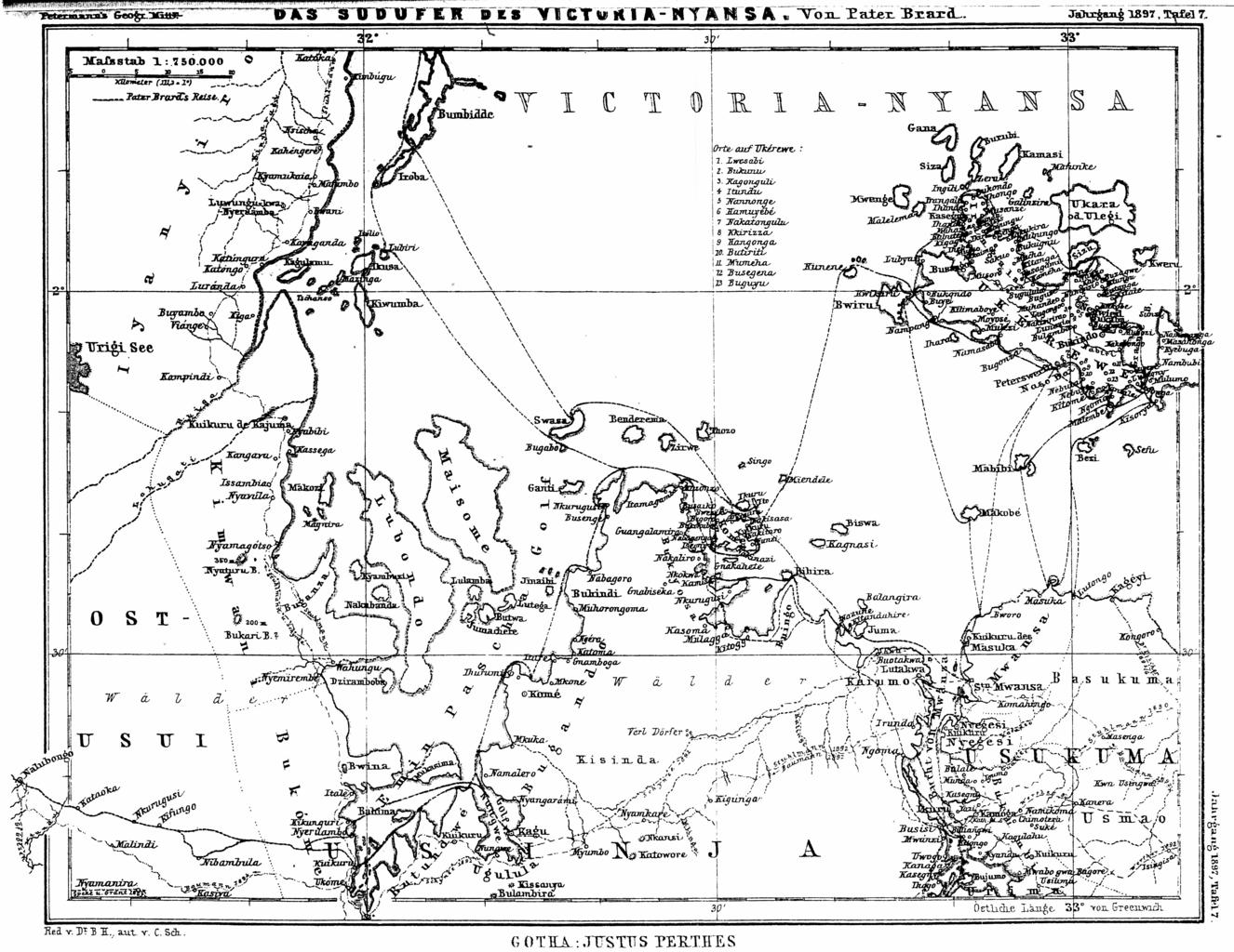
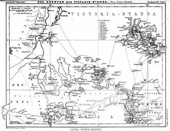
Viktoriasee Sdufer . en Map of the south western banks of the Lake Victoria then Lake VictoriaNyansa in the northwestern zoning area of the then colony German East Africa with the travel routes of Pater Brard and other travellers of the map from in contemporary Tanzania Das Sdufer des VictoriaNyansa Dr Petermann's Mitteilungen