
Related Images


Download:
| Tiny | 74x128 | View | Download |
| Small | 148x256 | View | Download |
| Medium | 297x512 | View | Download |
| Original png | 432x743 | View | Download |
| Original as jpg | 432x743 | View | Download |
This image was acquired from
wikimedia. It was marked as Public Domain or CC0 and is free to use. To verify, go to the source and check the information there.
Looking for more info about this image?
Try a Google Reverse Image Search for it.
Try a Google Reverse Image Search for it.
Keywords from Image Description:
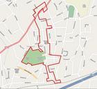
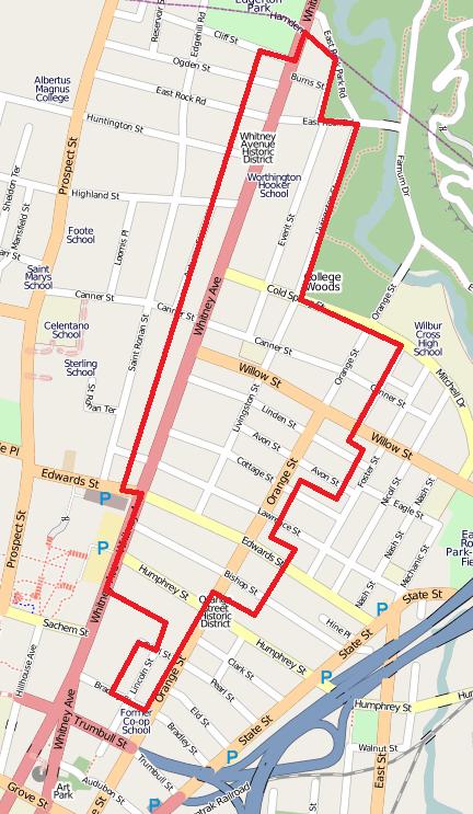
Whitney Avenue Historic District map. en December city map Map of approximate boundaries of Whitney Avenue Historic District based on City of New Haven planning maps and using imagery from OpenStreetMap See also NRHP application for the district William Devlin and Bruce Clouette June National Register of Historic Places InventoryNomination