
Related Images


Download:
| Tiny | 230x128 | View | Download |
| Small | 460x256 | View | Download |
| Medium | 921x512 | View | Download |
| Large | 1842x1024 | View | Download |
| Original png | 3601x2001 | View | Download |
| Original as jpg | 3601x2001 | View | Download |
This image was acquired from
wikimedia. It was marked as Public Domain or CC0 and is free to use. To verify, go to the source and check the information there.
Looking for more info about this image?
Try a Google Reverse Image Search for it.
Try a Google Reverse Image Search for it.
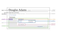
Keywords from Image Description:
longitudetime visualization . en The yaxis up represents time the xaxis left represents space geolocation The further down the closer you are to the present the further up the more you go in the past Time is given in rational scale the th century gets much more space than the st century The xaxis represents longitude with the