
Related Images


Download:
| Tiny | 94x128 | View | Download |
| Small | 188x256 | View | Download |
| Medium | 377x512 | View | Download |
| Original gif | 387x525 | View | Download |
| Original as jpg | 387x525 | View | Download |
This image was acquired from
wikimedia. It was marked as Public Domain or CC0 and is free to use. To verify, go to the source and check the information there.
Looking for more info about this image?
Try a Google Reverse Image Search for it.
Try a Google Reverse Image Search for it.
Keywords from Image Description:
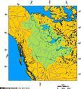
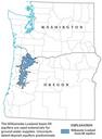
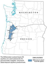
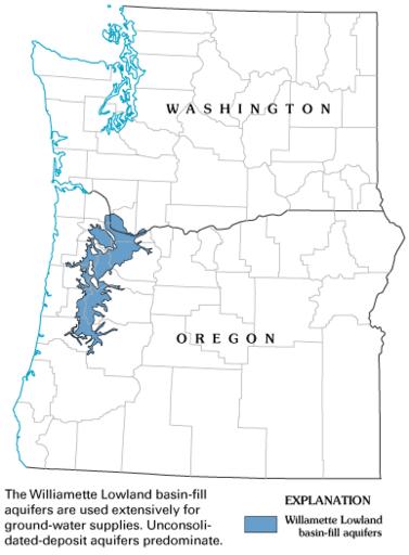
Willamette Lowland basinfill aquifer extent. en Map showing Willamette Lowland basinfill aquifer extent includes Oregon and Washington State with county boundaries with aquifer coloured blue date usgs gov US Geological Survey other versions PDUSGov Geological maps of Oregon Maps of Oregon Aquifers