
Related Images


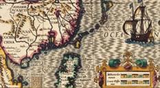
Download:
| Tiny | 93x128 | View | Download |
| Small | 187x256 | View | Download |
| Medium | 374x512 | View | Download |
| Original png | 463x633 | View | Download |
| Original as jpg | 463x633 | View | Download |
This image was acquired from
wikimedia. It was marked as Public Domain or CC0 and is free to use. To verify, go to the source and check the information there.
Looking for more info about this image?
Try a Google Reverse Image Search for it.
Try a Google Reverse Image Search for it.
Keywords from Image Description:
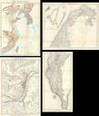
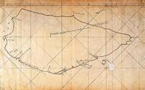
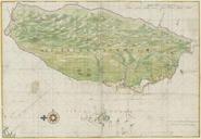
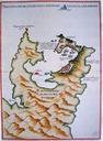
Map of Keelung and Tamsui Harbor FormosaTaiwan by Spanish . Uploaded with en wp UW marker en This maps shows the ports of Keelung and Tamsui harbor during the Spanish Formosa period in Taiwan Original publication br Immediate source illinoisstate edu No pdf Unknownbr Life time th Century Other information en This was used