
Related Images


Download:
| Tiny | 167x128 | View | Download |
| Small | 334x256 | View | Download |
| Medium | 669x512 | View | Download |
| Large | 1339x1024 | View | Download |
| Original | 1802x1378 | View | Download |
This image was acquired from
wikimedia. It was marked as Public Domain or CC0 and is free to use. To verify, go to the source and check the information there.
Looking for more info about this image?
Try a Google Reverse Image Search for it.
Try a Google Reverse Image Search for it.
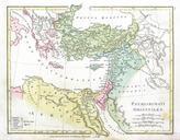
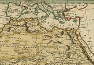
Keywords from Image Description:
Wilkinson Map of the Eastern Churches. Map of the Eastern Churches in the Pentarchy circa CE Wilkinson's Atlas Classica being Collection of Map of the Countries Mentioned by the Ancient Authors both Sacred and Profane Robert Wilkinson mapmaker public domain Wilkinson Map of the Eastern Churches rectified PDold Original upload