Related Images


Download:
| Tiny | 190x128 | View | Download |
| Small | 381x256 | View | Download |
| Medium | 762x512 | View | Download |
| Large | 1524x1024 | View | Download |
| Original | 6000x4030 | View | Download |
This image was acquired from
wikimedia. It was marked as Public Domain or CC0 and is free to use. To verify, go to the source and check the information there.
Looking for more info about this image?
Try a Google Reverse Image Search for it.
Try a Google Reverse Image Search for it.
Keywords from Image Description:
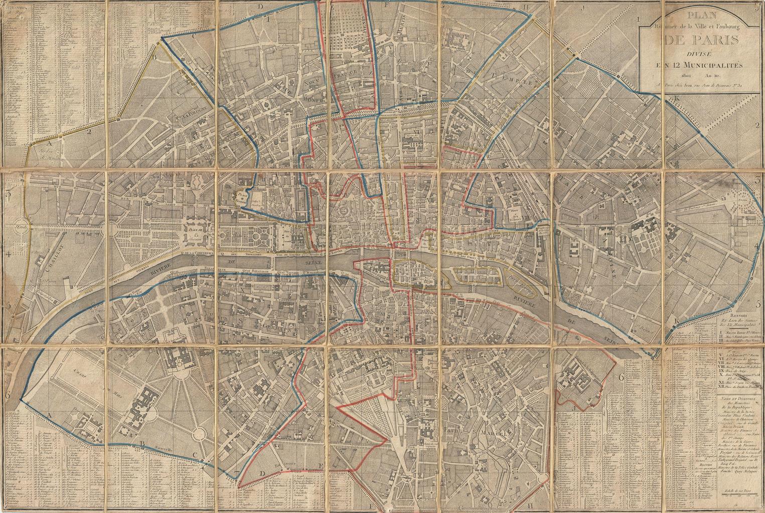
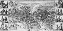
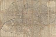
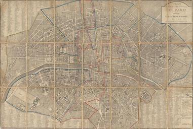
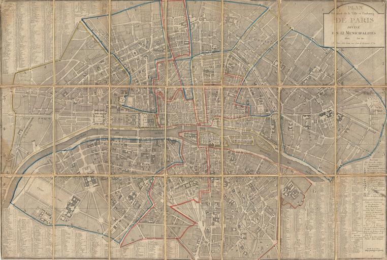
Chez Jean Map of Paris in Municipalities France Geographicus Parisjean. An extraordinary map of preHaussmann Paris and the early Faubourgs suburbs issued in following Napoleon Bonaparte's reorganization of the city into Municipalities Covers Paris on both sides of the Seine from the Champ de Mars to Le Trone extends north