
Related Images
Download:
| Tiny | 179x128 | View | Download |
| Small | 358x256 | View | Download |
| Medium | 717x512 | View | Download |
| Large | 1435x1024 | View | Download |
| Original | 3500x2496 | View | Download |
This image was acquired from
wikimedia. It was marked as Public Domain or CC0 and is free to use. To verify, go to the source and check the information there.
Looking for more info about this image?
Try a Google Reverse Image Search for it.
Try a Google Reverse Image Search for it.
Keywords from Image Description:
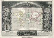
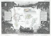
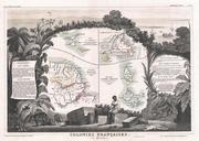
Levasseur Map of Guyana Miquelon Newfoundland and St. Martin Geographicus GuyaneMiquelonlevasseur. This is an Levasseur map of the French Colonies in America including French Guyana Newfoundland not French colony in still British colonish and not then part of Canada Miquelon and St Pierre and St Martin Miquelon and St Pierre