Related Images


Download:
| Tiny | 159x128 | View | Download |
| Small | 319x256 | View | Download |
| Medium | 638x512 | View | Download |
| Large | 1276x1024 | View | Download |
| Original | 4000x3210 | View | Download |
This image was acquired from
wikimedia. It was marked as Public Domain or CC0 and is free to use. To verify, go to the source and check the information there.
Looking for more info about this image?
Try a Google Reverse Image Search for it.
Try a Google Reverse Image Search for it.
Keywords from Image Description:
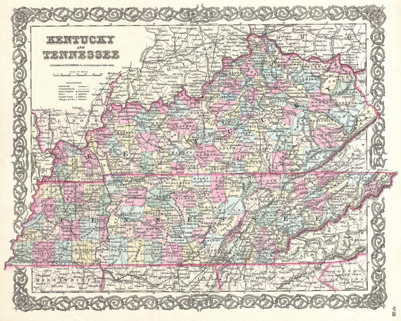
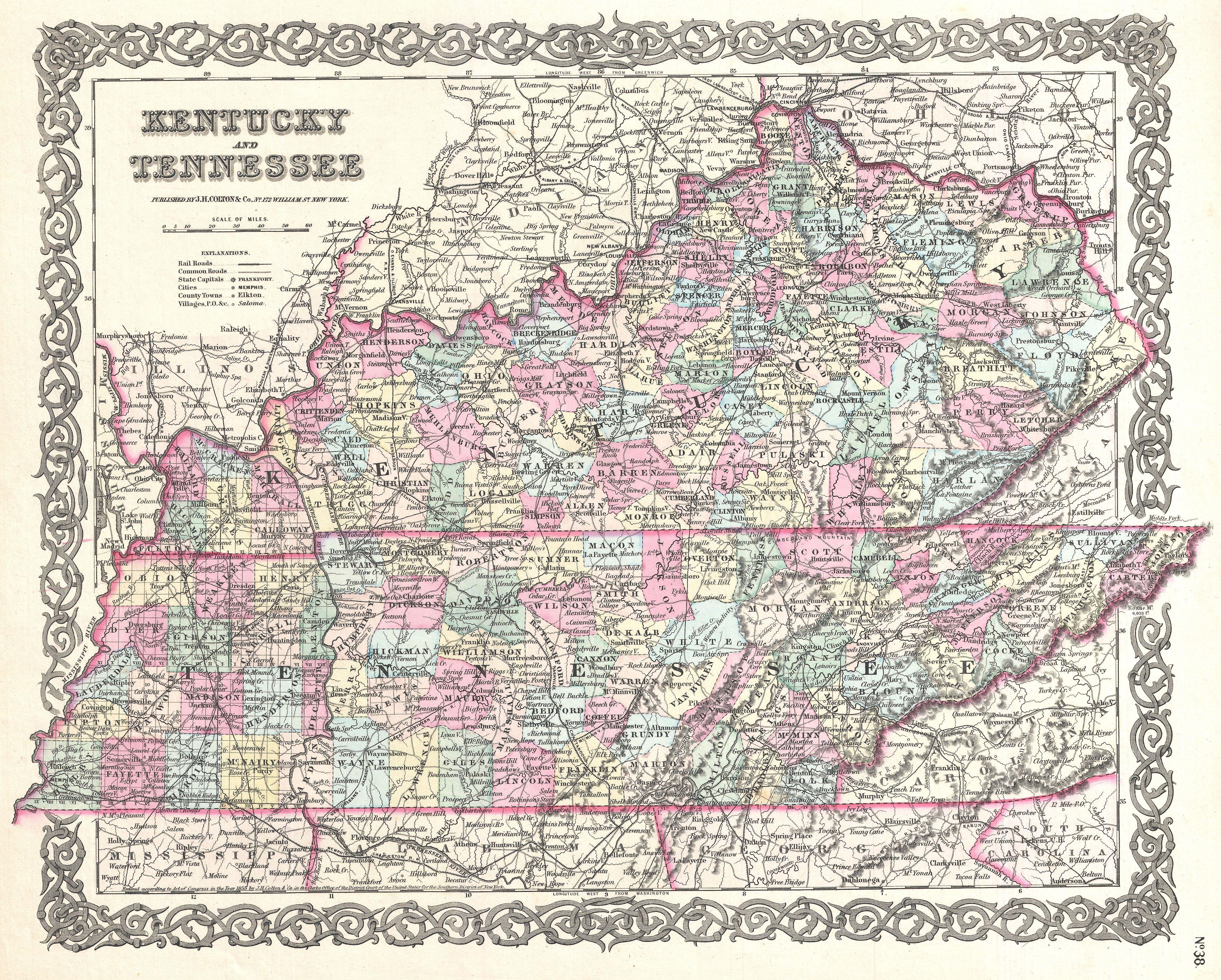
Colton Map of Kentucky and Tennessee Geographicus KentuckyTennesseecolton. beautiful first edition example of Colton's map of Kentucky and Tennessee Covers both states in full as well as parts of the adjacent states Like most of Colton's state maps this map is largely derived from an earlier wall map of North America produced