Related Images
Download:
| Tiny | 113x128 | View | Download |
| Small | 226x256 | View | Download |
| Medium | 452x512 | View | Download |
| Large | 904x1024 | View | Download |
| Original | 4417x5000 | View | Download |
This image was acquired from
wikimedia. It was marked as Public Domain or CC0 and is free to use. To verify, go to the source and check the information there.
Looking for more info about this image?
Try a Google Reverse Image Search for it.
Try a Google Reverse Image Search for it.
Keywords from Image Description:
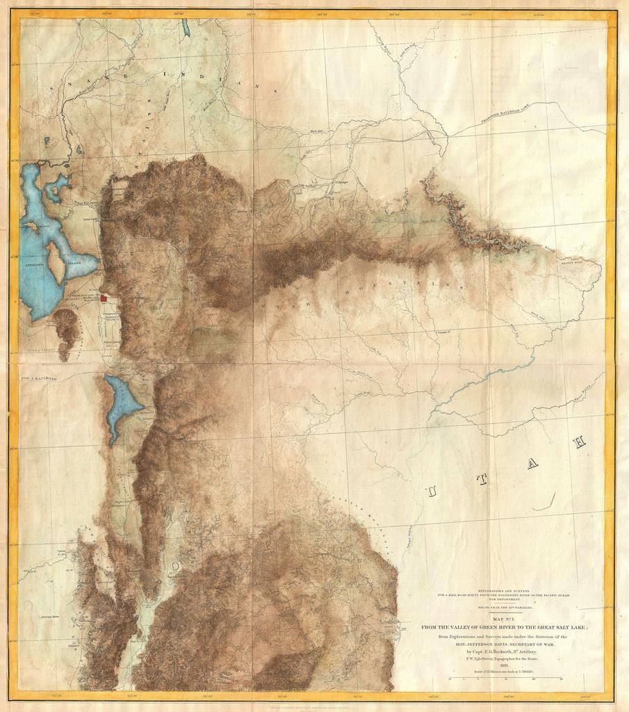
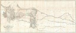
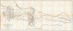
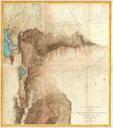
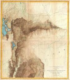
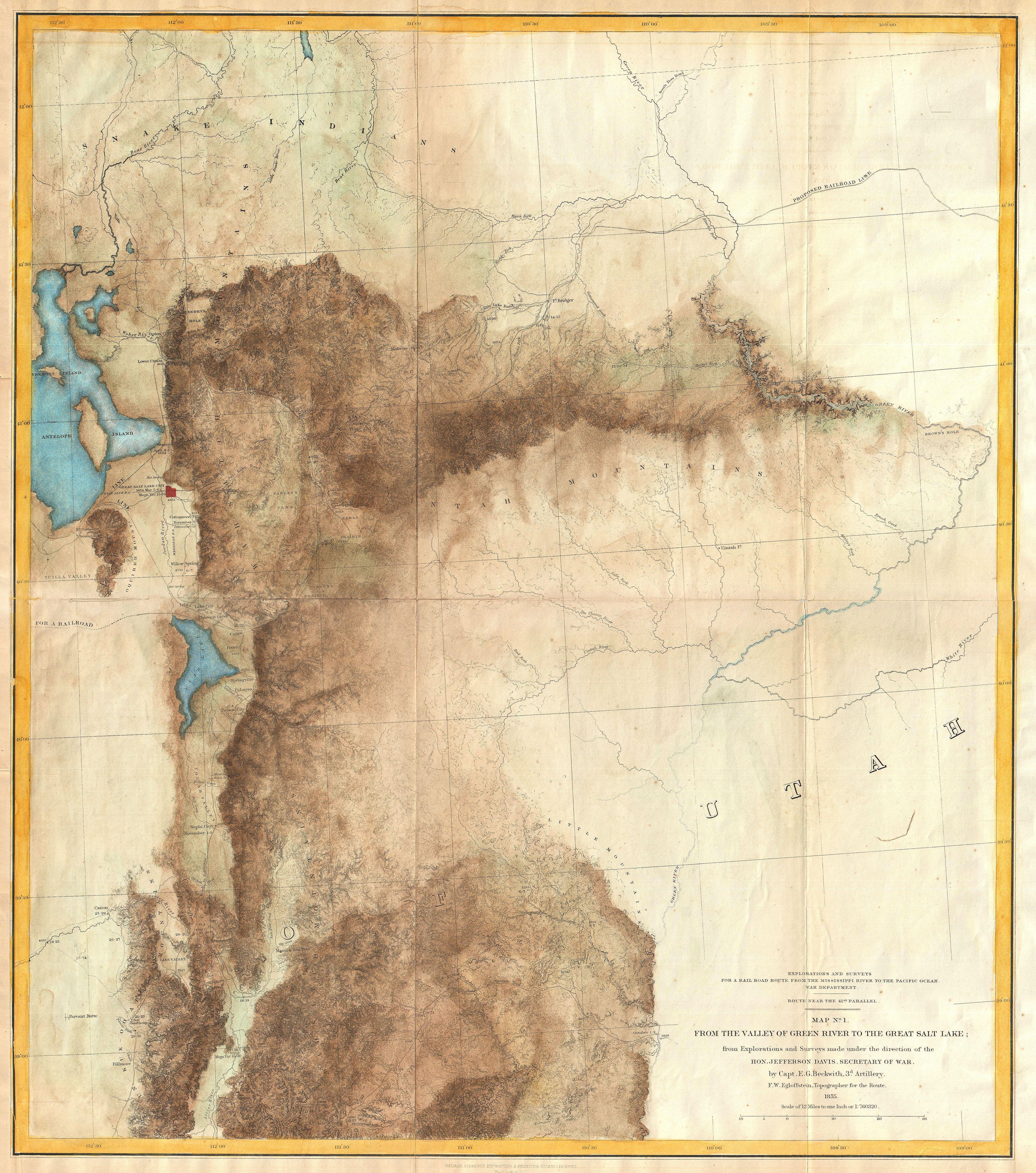
Jefferson Davis Map of Utah Salt Lake City and the Green River Valley Geographicus GreenRiverSaltLakedavis. This is rare and important map of parts of Utah and Wyoming prepared for the Pacific Railroad Survey Covers from the Great Salt Lake eastward to the Green River Valley and Brown Hole Extends southward as far as Fillmore