
Related Images


Download:
| Tiny | 159x128 | View | Download |
| Small | 318x256 | View | Download |
| Medium | 637x512 | View | Download |
| Large | 1275x1024 | View | Download |
| Original | 3000x2408 | View | Download |
This image was acquired from
wikimedia. It was marked as Public Domain or CC0 and is free to use. To verify, go to the source and check the information there.
Looking for more info about this image?
Try a Google Reverse Image Search for it.
Try a Google Reverse Image Search for it.
Keywords from Image Description:
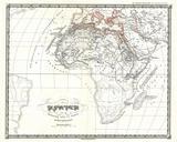
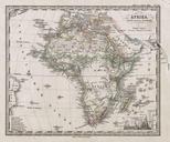
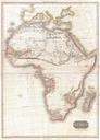
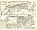
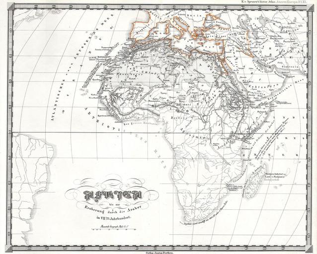
Perthes Map of Africa prior to the Arab Invasions of the th Century Geographicus AfricaPreArabperthes. This fascinating hand colored map depicts Africa prior to the Arab invasions and subsequent costal colorizations of the th century Most of South and central Africa is completely unknown Published as part of Karl von Spruner Historical