
Related Images


Download:
| Tiny | 204x128 | View | Download |
| Small | 409x256 | View | Download |
| Medium | 819x512 | View | Download |
| Original png | 829x518 | View | Download |
| Original as jpg | 829x518 | View | Download |
This image was acquired from
wikimedia. It was marked as Public Domain or CC0 and is free to use. To verify, go to the source and check the information there.
Looking for more info about this image?
Try a Google Reverse Image Search for it.
Try a Google Reverse Image Search for it.
Keywords from Image Description:
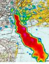
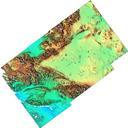
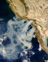
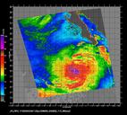
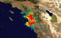
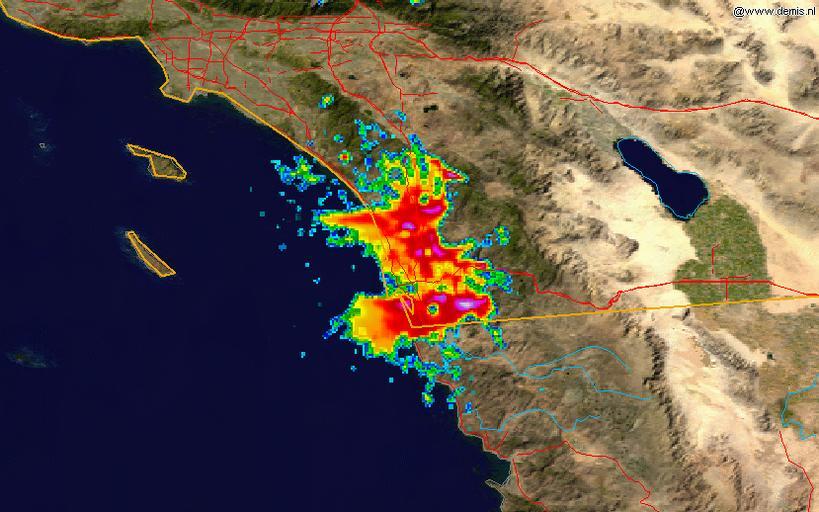
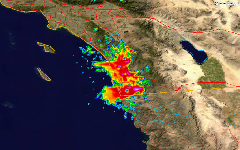
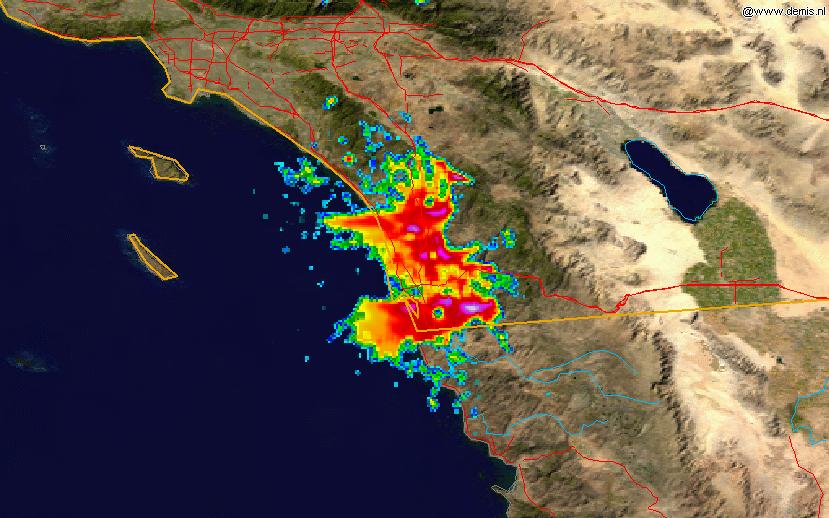
SanDiegoFiresradarz. This radar image shows the smoke plume from the southern California fires of on at UTC overlain on map The data is from the NWS NEXRAD radar at KNKX San Diego and was processed in the NCDC's ncdc noaa gov JAVA NEXRAD tool Radar data is from the ncdc noaa gov NCDC NEXRAD database and the background map