
Related Images


This image was acquired from
wikimedia. It was marked as Public Domain or CC0 and is free to use. To verify, go to the source and check the information there.
Looking for more info about this image?
Try a Google Reverse Image Search for it.
Try a Google Reverse Image Search for it.
Keywords from Image Description:
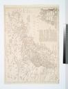
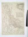
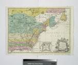
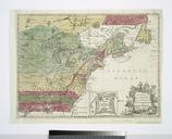
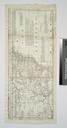
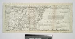
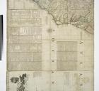
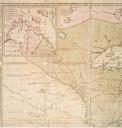
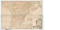
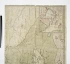
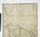
A Map of the British and French settlements in North America NYPL b. en Univ Mag Copy in Map Div Ford Collection From the Universal magazine of knowledge and pleasure Oct Inset Fort Frederick at Crown Point built by the French National Endowment for the Humanities Grant for Access to Early Maps of the Middle Atlantic Seaboard