Related Images


Download:
| Tiny | 194x128 | View | Download |
| Small | 389x256 | View | Download |
| Medium | 779x512 | View | Download |
| Large | 1559x1024 | View | Download |
| Original tiff | 5883x3864 | View | Download |
| Original as jpg | 5883x3864 | View | Download |
This image was acquired from
wikimedia. It was marked as Public Domain or CC0 and is free to use. To verify, go to the source and check the information there.
Looking for more info about this image?
Try a Google Reverse Image Search for it.
Try a Google Reverse Image Search for it.
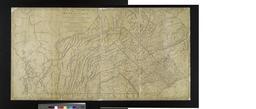
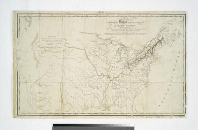
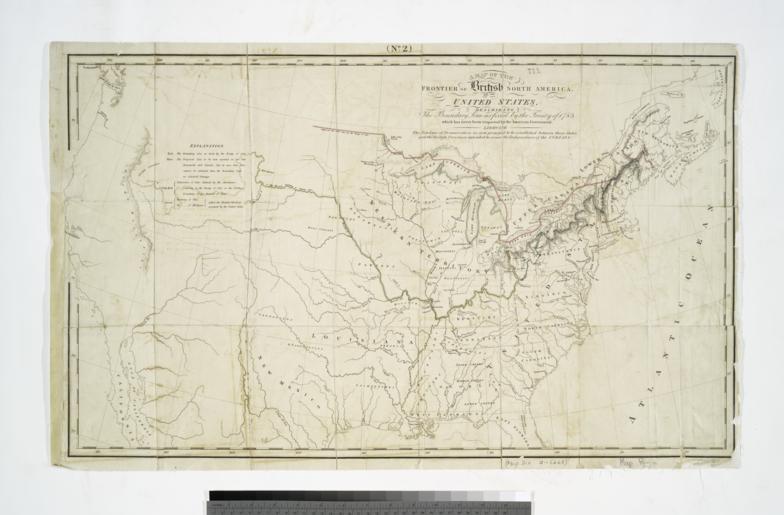
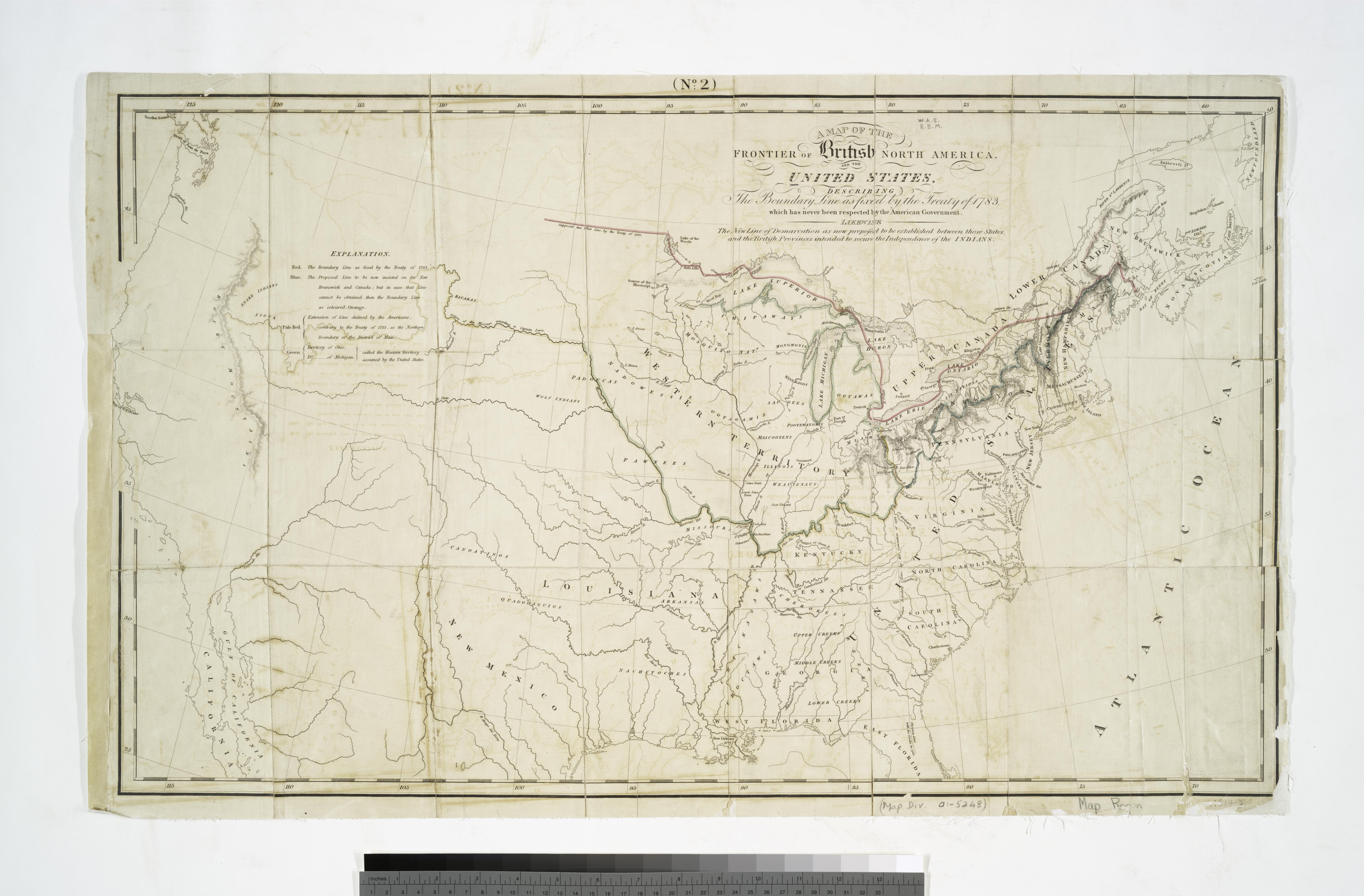
Keywords from Image Description:
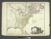
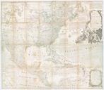
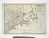
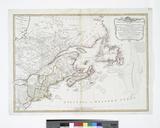
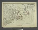
A Map of the frontier of British North America and the United States describing the boundary line as fixed by the Treaty of which has never been respected by the American government ... NYPL. map hand col cm nypl org cfm imageID At head of the map No Note From Nathaniel Atcheson's compressed view of the points to be discussed